Halswell Domain

Halswell Domain
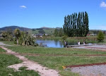
View from the Model Engineers' site in the Halswell Domain

Saturday, June 7, 2014

PLANNED CHANGES TO LOCAL BUS SERVICES


PLANNED CHANGES TO LOCAL BUS SERVICES
Many people have contacted us regarding the proposed changes to the local bus services.  Below is an outline of the changes.   Have a read and put in your submission by Monday 16th June at the link at the bottom of this post. 

Planned changes to bus services across the city are now out for comment.  You can find details including maps and an outlined of all changes at http://www.metroinfo.co.nz/news/Pages/Metro-Bus-Services-Review-May-2014.aspx#plan

Of particular interest to Halswell People are changes to the current #7 Halswell Queenspark and the #60 Hillmorton – Parklands services.   The Metrostar will be replaced by the #100 service and the Comet

What is planned?

The #7: Halswell-Queenspark
This will run from Halswell West to the supermarket hub and then straight up Halswell Road and Lincoln Road, past the hospital and into the central city before heading out to the Palms and Burwood Hospital.
The services will go every 10 mins during peak times and 15 mins during off peak (about the same as now)
The #60
Will travel between Halswell, central city and the Palms via Halswell Road through Hoon Hay, Barrington Mall and then down Selwyn St to Hagley Ave. This service is largely unchanged at the Halswell end, but will extend to cover Halswell on the Park subdivision.  From the Central City there will be a new route out to the The Palms and New Brighton and the #60 will no longer travel via Burwood Hospital.
The service will go every 15 mins peak time and 30 mins off peak
 The #100
This service will travel from Halswell School past the Supermarket,down Oakridge to Wales St then down Checketts Ave, through Westlake to Dunbars Rd, Awatea Rd before turning right and travelling through Wigram Skies and coming out onto Birmingham Drive (once the new roading and overbridge is put into that area). From Birmingham Drive it travels to Riccarton Mall.  From there it will go down Riccarton Rd to Staven Rd, then through to Heaton Street, Merivale Mall and then the Palms via St Albans.
This service will go every 15 mins peak time and 30 mins off peak

The Comet
The Comet is Halswell’s link to Hornby, and the Airport.  It will go from the Supermarket Hub round the Nichols Junction Halswell Triangle then along to Dunbars Rd, McMahon Dr, Aidanfield Drive then through Wigram Skies to Springs Road, Amyes Road.  From there it goes through the Hub at Hornby before going down Carmen Road, and Russley Rd to the Aiport and then on through to Northlands via Memorial Ave, Roydvale Ave and Harewood Rd. The route between Northlands and Redwood will remain the same as current route.
This service will go every 15 mins during peak times and every 30 mins during off peak times.

Possible Issues 

1) A lack of services to schools from different parts of Halswell. 
Children bussing into Halswell to go to Aidanfield, or Discovery schools will have to get off the bus and cross Halswell Road in an 80km zone where there are no refuges or other ways to safely cross.
Highschool children will not now be able to easily get over to schools in the Riccarton/ Middleton area.  Depending on where you live in Halswell, it could also take two buses to get to Hillmorten High.

2) All services up to Kennedys Bush will stop.

3) There is no mention of park and ride facilities or even places to lock up bicycles safely for the day.

4) At peak times the services might not run often enough to offset the need that many will have to change buses in Halswell, depending on where they want to go.  Changes that don't work well can make the difference between a trip taking 1/2 an hour or 1.5 hours to get from A to B.

How will these changes affect you?  Please let Environment Canterbury know by going to http://www.metroinfo.co.nz/Pages/Metro-Bus-Services-Review-Feedback-form.aspx  and filling in your feedback.  

Read the outline from David Hawke of the Halswell Residents Association below to see what they think about the proposed changes.  Feel free to pick and choose from these and add to them depending on your own opinions and concerns


What do you like about the proposed services?.

  • Increased coverage, to Halswell on the Park and to the new subdivisions in Halswell West. Coverage of the Halswell West subdivisions will decrease their isolation from the rest of Halswell.
  • Link from Halswell to the Airport (the Comet). Getting the bus to the airport from Halswell is presently too hard to be of any use.
  • More direct route to central city for no. 7 bus, which should make the transit time more acceptable. Currently in rush hour this is 45 min or more.
  • Increased frequency for no. 7 bus will be hugely helpful (although the times of the day the service runs will be critical - see below).


What would you change?

  • Matching bus routes to primary school zones would facitate use by children travelling to school. Particular examples are:

1.      Bus coverage to Halswell School from its enrolment zone is limited;

2.      Oaklands & Aidanfield lose their bus route to Halswell's local (in-zone) secondary school (Hillmorton High School)

The provision of dedicated school buses as part of the Metrostar replacement does not address the above examples.

  • The loss of coverage for Aidanfield reinforces that suburb's isolation from any cultural facilities, whether in Halswell (the pool, library, sports fields, local shops, bars/cafes) or wider Christchurch (sports stadiums, events venues). .


Would you like to make any further comments?

  • A good bus service (frequent, reliable, comfortable, clean) should decrease congestion and (if people choose to live car-free or car-lite) make life less expensive and more civilised.
  • Service times must allow for shift workers 7 days a week. This includes shift change times at Christchurch Hospital and Princess Margaret Hospital in paticular.
  • Buses need somewhere to park while waiting for their next run, so provision of some sort of bus interchange in or near Halswell should be accelerated.
  • The implementation of the bus priority lane along Halswell Rd (and associated four-laning) needs to be accelerated to make the most of the increased frequency of the no. 7 bus.

Tuesday, May 20, 2014

Statistics from the last Census

As most people are aware, 2013 was the year of our last national Census.  Results are still coming out but many came out at the end of last year.

Two infographics that may be of interest are:
This one looking at changes since the last Census in 2006 and presenting them as if New Zealand were a village of 100 people, and

This one about the changes to Greater Christchurch (Christchurch City, Selwyn District, and Waimakariri) post earthquakes.


Christchurch City Council have also put together some of the Census information for Halswell.  You can look at it on this page on the Halswell Community Website.

Of interest is:
  • The main growth has happened in Aidanfield, Westmorland and Halswell on the Park.  
  • There are  a similar number of people aged less than 15 compared with the rest New Zealand. 
  • There are fewer single people living here than in the rest of Christchurch and NZ.
  • We are not a very diverse lot - with a high number of Europeans and low numbers of other groups (Maori, Pacific or Asian).
  • Overall, we are a very well off community:  the mean household  AND mean personal income in Halswell is well above that of both Christchurch and New Zealand.
  • 52 percent of people are in full time employment compared with 48% for the whole of New Zealand
  • Relatively few people living here are renting and rents are high compared to the rest of Christchurch and there are a lot of large houses here compared with the rest of the country.
  • 87% of us have internet access (compared with only 79% across NZ)
Find out more by checking out the link above.  Another good place to look at information is here where you can play around with a map and check out figures for all the area units around Halswell.

At this stage I haven't managed to work out exactly how many people were living here on Census night in 2013! Watch this space of work it out for yourself and write a comment about it below.

You may also be interested in some of the recent research that has been completed around Halswell and which you can find on this page on our website.

Wednesday, April 30, 2014

Transport around Halswell - what to do?


Halswell has a range of transport issues. 

  • As anyone around Halswell will know, congestion on Halswell Road is an issue during rush hour.  
  • For local schools and for families wanting to get children to and from school safely, the 60km/hr speed limits and lack of adequate crossing points are an issue. 
  • Parents who feel compelled to drop their kids off and pick them up from school to keep them safe, have themselves created a major traffic hazard around schools.
  • Cyclists have to contend with fast traffic and increasingly angry motorists who don't have any idea how it feels to be on a bike. 
  • Pedestrians often have to wait a considerable time before they are able to cross the road safely in places around Halswell.  If you are struggling with mobility issues because of injuries or illness, the problem is even worse.
  • For people living down Halswell, and Junction Roads, traffic noise and traffic related pollution is making our place increasingly unpleasant.
  • People trying to turn right out of Nichols Road or School Road onto Halswell Road are finding it increasingly difficult to get across even when traffic is not heavy.

Add to this the large developments such as Longhurst and Knights Stream and the continuing development of Aidanfield, and the new Meadowlands development, it is clear that things are set only to get worse for Halswell residents in the near future. 
While each of these have pretty good walking and cycling facilities within each development, as has been the case for areas such as Country Palms, Aidanfield and Halswell on the Park,  there are problems for anyone trying to get between these developments and major community facilities such as schools, shops, sports grounds etc.  

Things that would assist these problems are: 

  • Off road cycle paths, which get a few people out of their cars and onto their bikes (even a few more people biking can make a significant difference to traffic congestion for those who choose to stay in their cars).  Cycling is currently the fastest, most efficient way to get from home to town, and many people do enjoy cycling but not when they feel unsafe as a result of the large volumes of car traffic, and a lack of cycle facilities.
  • Bus lanes which make it quicker and more pleasant for people who choose to catch a bus rather than take their car.  (Again, even a few more people catching a bus can make a difference to traffic congestion).  However because buses get stuck in traffic, taking the bus is not a great option for people.
  • Traffic lights, 
  • Pedestrian refuges and safe routes to school
  • Lower speed limits in some areas
The space taken up on our roads by the same number of cars buses bikes and pairs of feet

Sadly at this point, and despite the development here, there are no plans for any of these things in the Lincoln/Halswell Road area in the foreseeable future.  The off road cycle path that is planned as part of the new Christchurch cycle network, is planned to go up Sparks Rd.  The new cycle path along the southern motorway is not that useful for anyone living in Halswell wanting to get to work.  It would be good for those moving into the Knights stream area if Junction Road were not so unsafe for cyclists.  If we want to see good transport infrastructure around this area, we need to be taking some action and we need to do it soon.

If you have concerns about these things, a good thing to do is to write to the Riccarton-Wigram Community Board and the Christchurch City Council. Alternatively you could ring them.  Encourage your friends to do the same!  You could also get in contact with the Halswell Residents Association, who have asked the Council to do a transport plan for the area to manage the issues that we are already facing.

Without this kind of action, very little is likely to happen to sort out our suburb's transport issues.

Sunday, January 5, 2014

Walking and biking tracks around Halswell


Underpass from Aidanfield through to the cycleway

Halswell is a great place for walking and biking, and has some interesting places to explore.  This short article points you to some good places to go walking or biking away from the roads. You might also enjoy exploring some of the places in Halswell away from where you live - Aidanfield, Halswell on the park and Country Palms offer some nice walking and parks.  
Southern Motorway cycleway
From Aidanfield you can access the new cycleway along the motorway which is also a good place to walk.  You can see some pics and find out a wee bit more about this cycleway here,  and you may also be interested in seeing the route of the cycleway through to Barrington 

Local parks                                                                                                    
Part of Halswell Quarry Rim Track
Check out the local parks page on our Website  to find out a little more about great places to walk.  Westlake park, Canterbury Park, the Halswell Domain and Halswell Quarry Park all provide great places to go for short walks away from the road. 

Kennedys Bush Track
The Kennedys Bush Track runs from the top of Kennedy’s Bush Road.  It is around about an hour to an hour and a half’s walk for most from there to the Summit Road which offers great views and tracks to take you along to the Sign of the Bellbird which is about 20 mins to half an hour along on the tracks across the road and to your right.   
View of Lyttelton Harbour from Sign of the Bellbird
While you are heading that way, you may like to continue on and do a bit of Aoraki spotting as per this blog post written in the Halswell Community Blog in 2012 
  
Turn left instead of right and you can walk to the Sign of the Kiwi and beyond.  A favourite walk for me is to walk all the way along the summit Road to Lyttelton via the Bridle Path.  The earthquakes have made this more interesting but you can also choose to drop down Bowenvale, or Rapaki and catch a bus to get you back to Halswell if you don't like walking on closed roads.


Little River Rail Trail
Of course another great, relatively close trail is the Little River Rail Trail, which can be walked or biked.  
You can bike from Halswell, to Lincoln:  A good route is to use Quaifes, Longstaffs and trices roads to get you to the trail on Birches Rd in Prebbleton.  
From Lincoln you need to take to the roads for a while but after a few km the trail is once again off road (look at the rail trail website to see the route between Lincoln and Motukarara).  

Many people drive to Motukarara to do the section between there and Little River.  The trail here is a great way to see Te Waihora/ Lake Ellesmere, and the cafes both at Motukarara and Little River are very very good, particularly after a good bikeride.  Check out the Little River Rail Trail website for more info.

For those who would prefer to walk or run, these trails can also be used for these activities.